
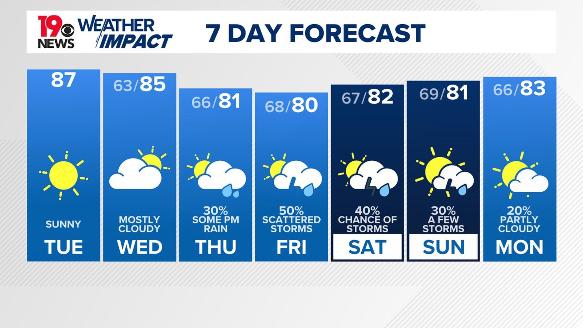
COLUMBIA, S.C. — Dry weather and near-normal temperatures are expected to continue through the middle of the week. However, changes are on the horizon as moisture begins to build over the Southeast, bringing an increased chance of rain by late Thursday. This wet pattern is likely to persist into Friday and Saturday, with temperatures dipping slightly below normal as the week draws to a close.
In the near term, today will bring seasonably cool and dry conditions, thanks to a high-pressure system over the area. The air is notably dry. Clear skies are expected for most of the day, though by tonight, cloud cover will increase as the ridge shifts eastward and the subtropical jet moves northward from the Gulf Coast.

Despite the increasing clouds, daytime highs should still reach the mid-80s, slightly warmer than yesterday. Overnight, the additional cloud cover and a slight increase in moisture will result in lows ranging from the upper 50s to the low 60s, making for a relatively mild night.
As we move into Wednesday and Thursday, dry weather will persist, although temperatures will remain just below average for this time of year.
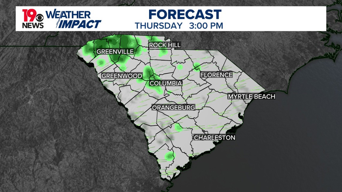
A wave of moisture is expected to push in from the southwest, driven largely by Tropical Storm Francine, which could intensify into a hurricane by Wednesday morning. While the storm will be far to the west, it will bring a significant increase in moisture to our area by late Wednesday and into Thursday, although rain chances will stay low through Thursday morning.
By Friday and Saturday, the weather pattern will shift more dramatically. The broad moisture boundary associated with Tropical Storm Francine will stall over the region. This will bring widespread showers, though thunderstorms are not expected to be a major concern. Heavy rain will be the primary risk, and there is a marginal chance of flash flooding, particularly in higher elevation areas like the Upstate and CSRA.
By Sunday, rain chances will begin to taper off as the upslope flow weakens, bringing drier conditions heading into the start of next week.