
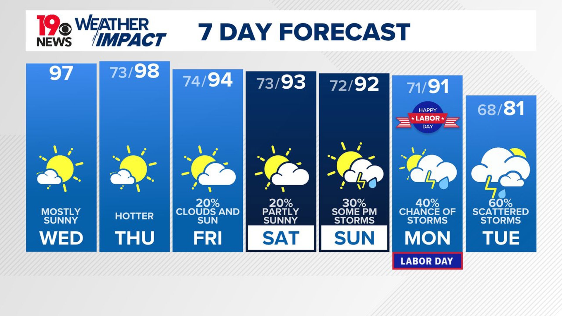
COLUMBIA, S.C. — Expect hot and humid weather to continue through Thursday, with temperatures soaring and very little chance of rain. A high-pressure system will keep the skies mostly sunny, even as moisture starts to build up in the area.
By the weekend, a weak front will move closer, increasing the likelihood of showers and thunderstorms and bringing temperatures down to more typical levels for this time of year. Early next week, a stronger cold front will arrive, leading to cooler, unsettled weather.
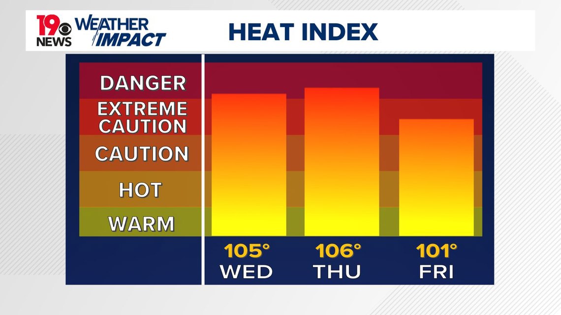
For today, the heat is expected to be intense, with the heat index reaching between 100 and 105 degrees. Despite the rising humidity, rain is unlikely as a strong high-pressure system continues to dominate the weather in the Southeast.

Winds will shift slightly, becoming more southerly, but they will remain light. You might see some clouds forming in the afternoon. Tonight, after the sun sets, the skies will clear up, and temperatures will drop to the lower 70s, though it will still feel warm.
Thursday’s weather will be much like today, with hot and humid conditions pushing the heat index back up to 100-105 degrees in the afternoon. Friday will be slightly cooler, but still warm, with heat indices between 98 and 103 degrees.
Rain chances will remain low, with only a small chance of showers, mostly in the northern Midlands. A weak front moving south might trigger a few late-day showers and thunderstorms, but most of the area will remain dry.
As we head into the weekend and early next week, the weather will start to shift. The high-pressure system will weaken, and a trough will take its place, leading to more frequent showers and thunderstorms.
Temperatures will still be a bit above normal for late August, but by Monday and Tuesday, a cold front will bring cooler weather and higher chances of rain. This will be the next best opportunity for widespread showers and thunderstorms across the region.