
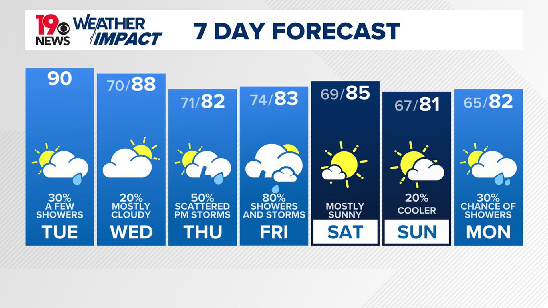
COLUMBIA, S.C. — A high-pressure system over the Southeastern United States is maintaining warm conditions across the region through midweek. However, multiple weather systems are expected to move through the area, bringing periods of rain.
More importantly, a tropical system developing in the Gulf of Mexico is forecast to affect the Southeast later this week, particularly on Thursday and Friday. While confidence is increasing that the storm will bring impacts, there is still some uncertainty about the exact track and strength of the system as it moves inland.
In the near term, today and tonight will remain very warm, despite a weakening upper ridge. There is a marginal risk of severe thunderstorms, especially for areas north of Columbia. Scattered showers and thunderstorms are likely to develop this afternoon and evening, with heavier rain possible in some areas.

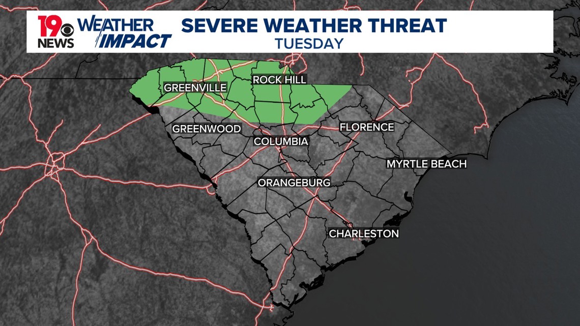
High moisture levels will fuel storms, potentially causing localized severe weather, including gusty winds and heavy downpours. Overnight, isolated showers may linger in the northern Midlands, but temperatures will remain mild, with lows around 68 to 70 degrees.
Looking ahead to Wednesday and Wednesday night, temperatures will stay above average, though they may be a few degrees cooler than earlier in the week. Rain chances will increase, especially during the afternoon and into the evening as a weather front approaches from the west.

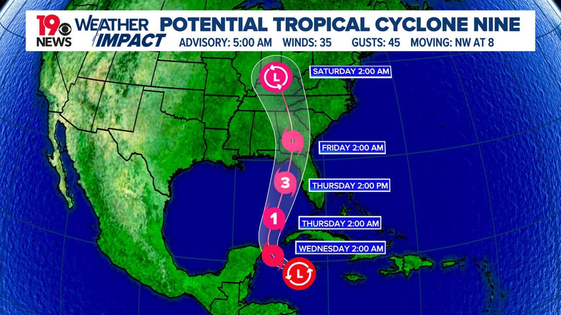
The tropical system, currently designated as Potential Tropical Cyclone 9 (PTC 9), is expected to continue moving northward toward the Gulf Coast. The storm may begin to influence weather conditions late Wednesday night, with scattered showers possibly reaching the region.
For Thursday and Friday, the tropical system is forecast to have its greatest impact on the Southeast. While the exact track remains uncertain, PTC 9 could make landfall around Florida’s Big Bend area and then continue moving north.

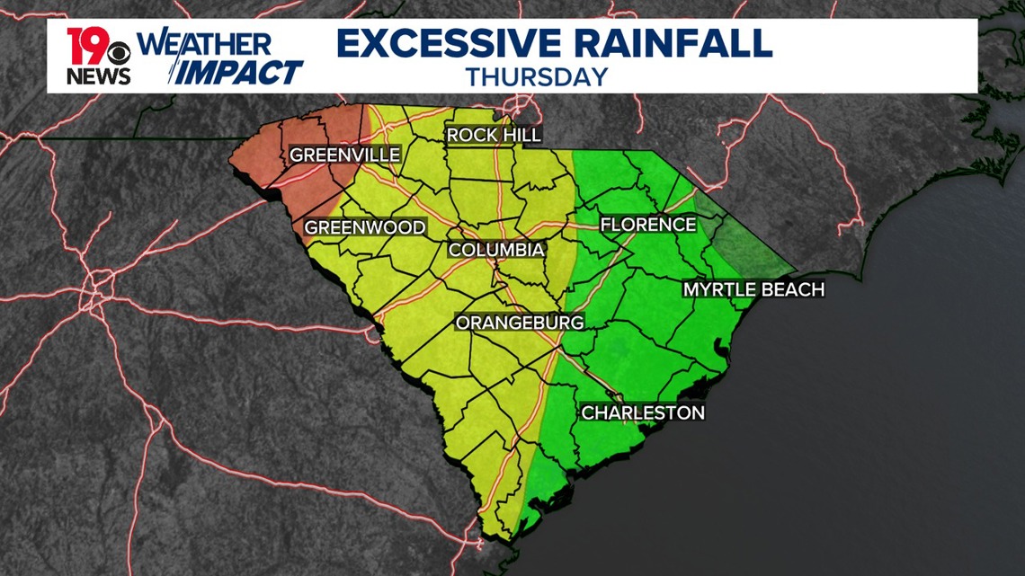
As the storm approaches, heavy rain, strong winds, and isolated tornadoes are possible across the region. Flooding could occur in areas where rainfall accumulates quickly. Though the system is expected to move relatively fast, it may still cause significant issues across South Carolina. The storm’s interaction with a weather system to the west could keep rain showers in the forecast into the weekend.
As the tropical system continues to develop, it is important to monitor local weather updates for potential changes in timing, intensity, and impact.