
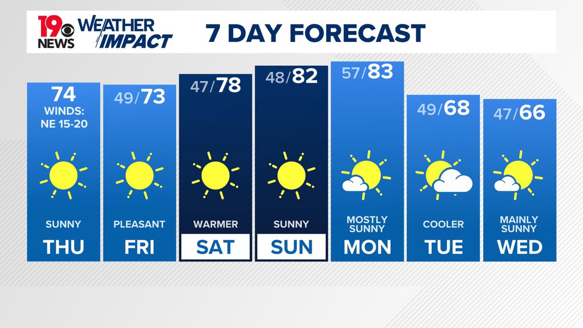
COLUMBIA, S.C. — A cool and dry air mass will settle over South Carolina, bringing a noticeable drop in temperatures. By Friday, below-normal temperatures are expected, with the weather remaining seasonably cool into the weekend.
Although Milton will stay well to the southeast of South Carolina, it will still generate breezy conditions across the area today. For the most part, dry weather and cooler-than-usual temperatures are expected to continue for the long term.
A wind advisory is in effect for most of the Midlands until 8:00 p.m. These gusty conditions may worsen existing issues caused by Helene’s powerful winds a couple of weeks ago.


Widespread damage is not anticipated; trees stressed by Helene may be vulnerable to these gusts. Despite the windy conditions, temperatures will be pleasant, with highs reaching the mid-70s. By tonight, the winds will calm, and temperatures will drop into the middle to upper 40s.
We are expecting a lot of sunshine on Friday. High temperatures will be in the lower to middle 70s for the last day of the workweek.
By Saturday morning, a ridge of high pressure will be in place, leading to temperatures in the low 70s. Overnight, strong radiational cooling will bring near-calm winds and low temperatures, with some areas possibly seeing lows in the lower 40s.
Dry and seasonable weather is expected over the weekend, but some much cooler air will move into the Midlands by Tuesday.
Ensemble models suggest that temperatures will moderate over the weekend, especially by Sunday as westerly winds bring warmer air. The surface ridge will move southeast, and an unusually deep upper trough will push into the eastern U.S. on Monday. This will drive a cold front through the area.
Most models predict the front will pass through with only a few clouds and no precipitation. Starting Tuesday, temperatures will drop to about 10 degrees below normal for this time of year, with cool and dry conditions continuing into midweek.