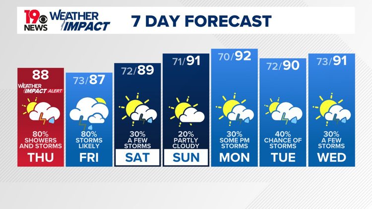
COLUMBIA, S.C. — The News19 Weather Team has issued a Weather Impact Alert Day through Thursday night for the Midlands due to the possibility of heavy rainfall and storms.
A Weather Impact Alert Day is a new type of announcement from News19's weather team that allows you to know when potentially hazardous weather is coming your way and how to prepare ahead of time.

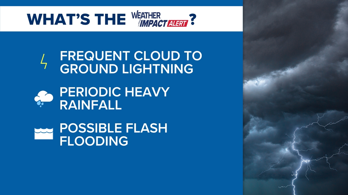
The biggest impact through Thursday will be heavy rainfall that could lead to flash flooding. The National Weather Service has issued a flash flood watch for most of the Midlands. Counties included in the flood watch include Richland, Lexington, Kershaw, Lee, Aiken, Sumter, Calhoun, northwestern Orangeburg, and central Orangeburg County


Recent heavy rainfall, combined with the threat of an additional 1 to 3" of rainfall between Wednesday evening and Thursday at midnight has led to concern for areas of flash flooding in the watch area. The flash flood watch remains in effect until Thursday at midnight.
.


On Friday the weather pattern will change slightly, as the western Atlantic ridge moves south of the area and an upper trough shifts into New England and the Mid-Atlantic region. A nearly stationary front will drop into the area, leading to more widespread showers and thunderstorms, especially in the afternoon and evening. There is still a chance of heavy rainfall in some locations, which could continue the risk of flooding.
On Saturday, expect scattered to numerous showers and thunderstorms, with the potential for heavy rainfall. From Saturday through Tuesday, the coverage of showers and thunderstorms will be less.