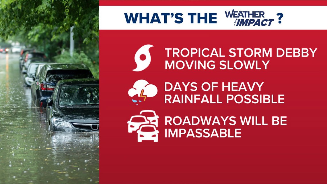
COLUMBIA, S.C. — More rain will take place later today from Tropical Storm Debby as the storm is still expected to bring flooding rains to a large section of the state.
The computer models have made some adjustments, slightly increasing the speed of the storm as we get into late Wednesday. What that now means is the storm could start passing out of the state by late Thursday afternoon, which when that happens, will end the threat of heavy rain.
Still, several more rounds of rain are expected, particularly late Wednesday and through Thursday morning. For that reason, the News19 Weather Team has declared Weather Impact Alert Days through Thursday due to the extreme flooding threat from Debby.
Here's your WLTX When-Impact-Need information over the next 48 hours.
WHEN:
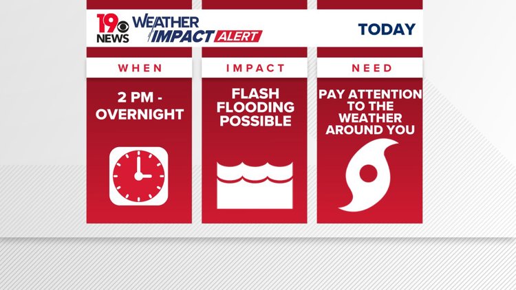
Heavy rains dropped several inches of rain in the Midlands Tuesday. On Wednesday morning there will be some gap in the rainfall as Debby moves slightly out into the Atlantic. However, rain will pick up in the later half of the day then increase overnight into Thursday. That's because the models now have the storm making a second landfall in South Carolina (the first was in Florida) sometime early Thursday morning, likely between Charleston and Myrtle Beach.
Thursday itself should see several more inches of rain, particularly in the eastern Midlands and the Pee Dee region of South Carolina as the storm tracks through the eastern part of the state. That will carry with it a risk of more flash flooding and hazardous conditions on the road.
Computer models now have the storm exciting the state by late Thursday afternoon into early Thursday evening. If that scenario plays out--and the models are in better agreement about this--the heavy rain could all be over Thursday.
Increasingly, the forecast for Friday is now improving.
IMPACT:
As Debby moves meanders off the coast Wednesday, it will continue to deliver continuous bands of rain. This will lead to rapidly rising rain totals.
As it moves closer to the state for a second landfall it will bring heavier rain. Current models suggest the landfall could be between Charleston and Myrtle Beach.
Flash flooding will be a risk and persist throughout the week until Friday. River flood warnings are in effect due to rising river levels. Roads in low-lying areas, highways, underpasses, and streets could become impassable.
NEED:
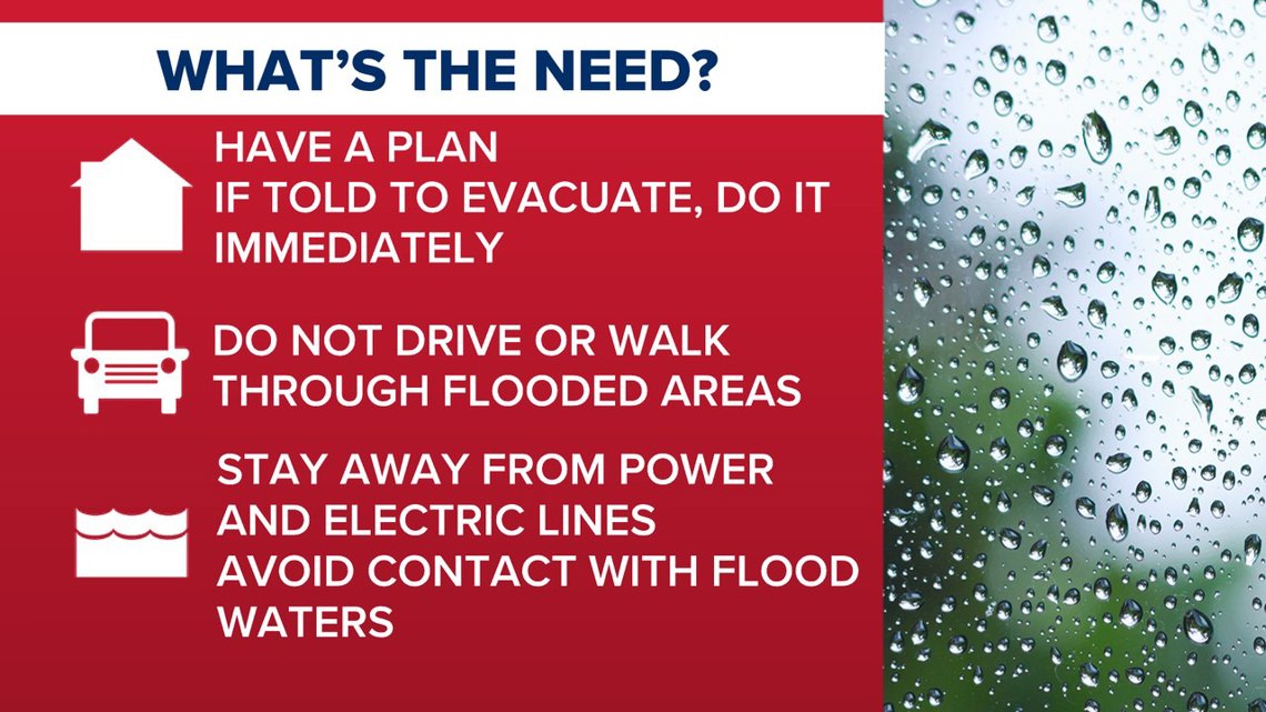
Residents are advised to stay inside as much as possible. If you must go out, please refer to the phrase " Turn around, don't drown! " Never drive through a flooded road.
People should be prepared to deal with power outages, and for those living in flood prone areas, be ready to evacuate immediately upon notice.