COLUMBIA, S.C. — According to the National Oceanic and Atmospheric Administration, since 1950 South Carolina has seen 10 landfalling hurricanes and dealt with countless more tropical storms that moved through the state, so we are no strangers to tropical weather.
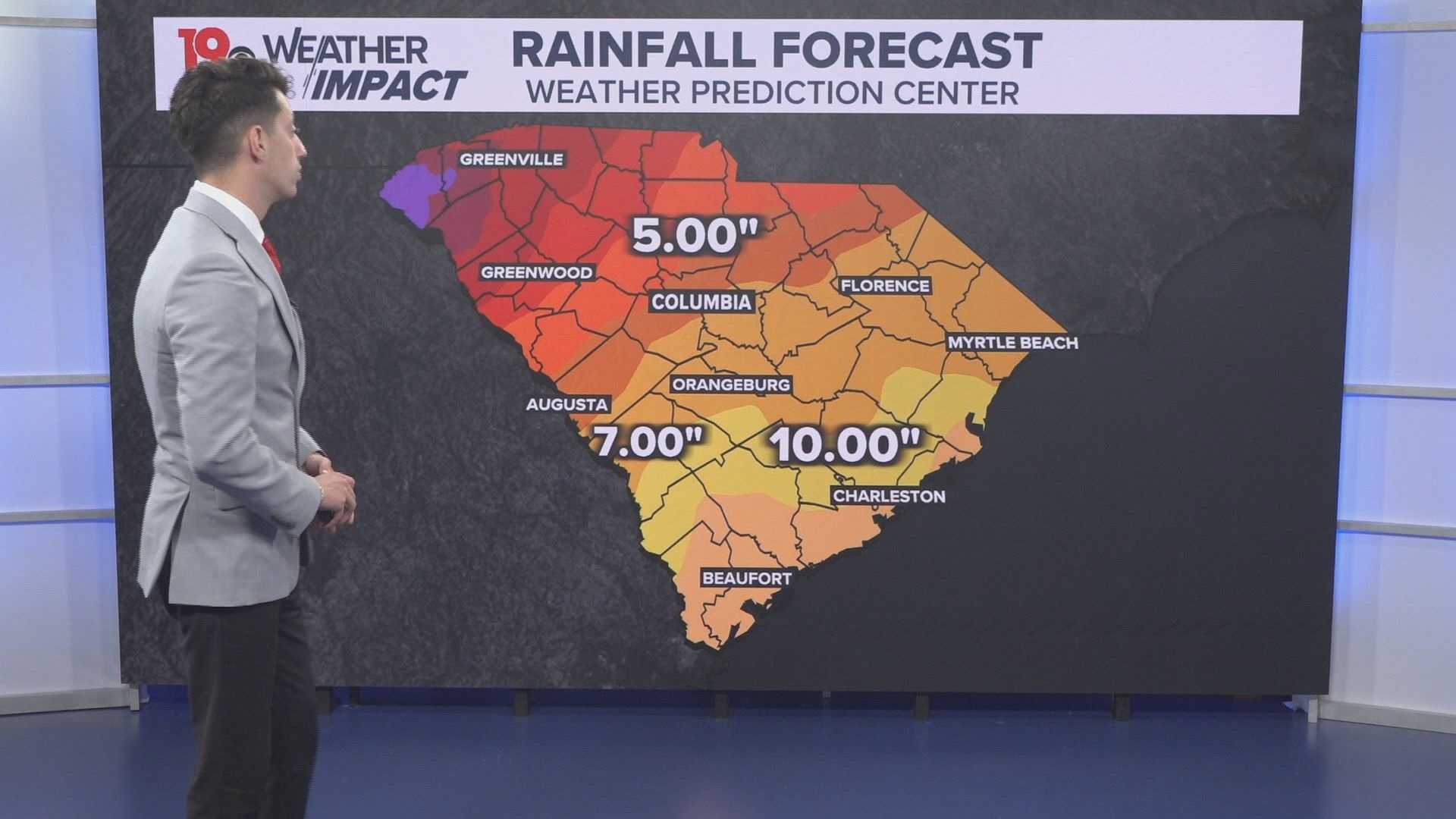
Debby will be impacting our weather this week, as the storm is expected to move through Georgia and Florida and finally stall out in the Atlantic just off the Georgia/South Carolina coast early this week. While it sits there, it will bring significant rainfall to the state, before eventually moving inland around midweek and bringing more rain and wind as it tracks through the state.
With those impacts looking extremely likely for South Carolina, it is important to know what we will be sharing with you before the storm arrives.
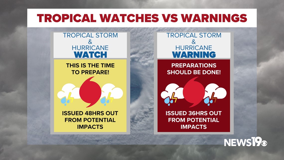
Watches and Warnings work a bit differently with tropical weather compared to severe storms. They are solely based on the time out from impacts. A tropical storm watch for example would be issued 48 hours out from impacts. This is the time that you should be preparing for the storm. A warning is issued at 36 hours out or less. At this point, all preparations for a storm should be done.


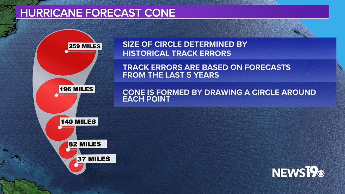
There is of course the forecast cone. The cone shows the path the center of the storm is expected to take and is based off of historical track error. It is very important to remember that very often impacts occur outside of this cone when it comes to hurricanes.


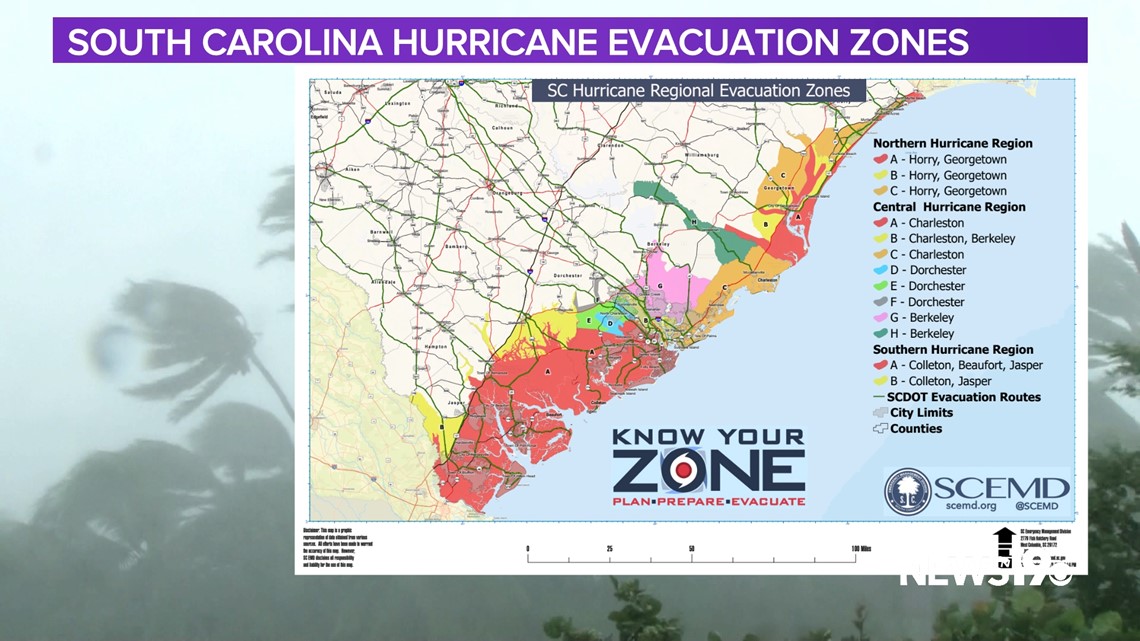
Of course, if larger impacts are expected our coasts could see evacuations ordered, the South Carolina Emergency Management Division uses these evacuation zones to help residents get to safer locations via hurricane evacuation routes that are placed all along the coast.


When it comes to this storm and most storms in our state, flooding rain is the largest concern so as we always say if you see flooded roads, turn around and don’t drown.
The News 19 weather team will continue to provide updates as Debby moves toward us over the coming days.

