
COLUMBIA, S.C. — Tropical Storm Helene in the Gulf of Mexico is forecast to affect the Southeast later this week, particularly on Thursday and Friday. While confidence is increasing that the storm will bring impacts, there is still some uncertainty about the exact track and strength of the system as it moves inland. Because of the potential threat, however, News19 has issued Weather Impact Alert Days for both Thursday and Friday.
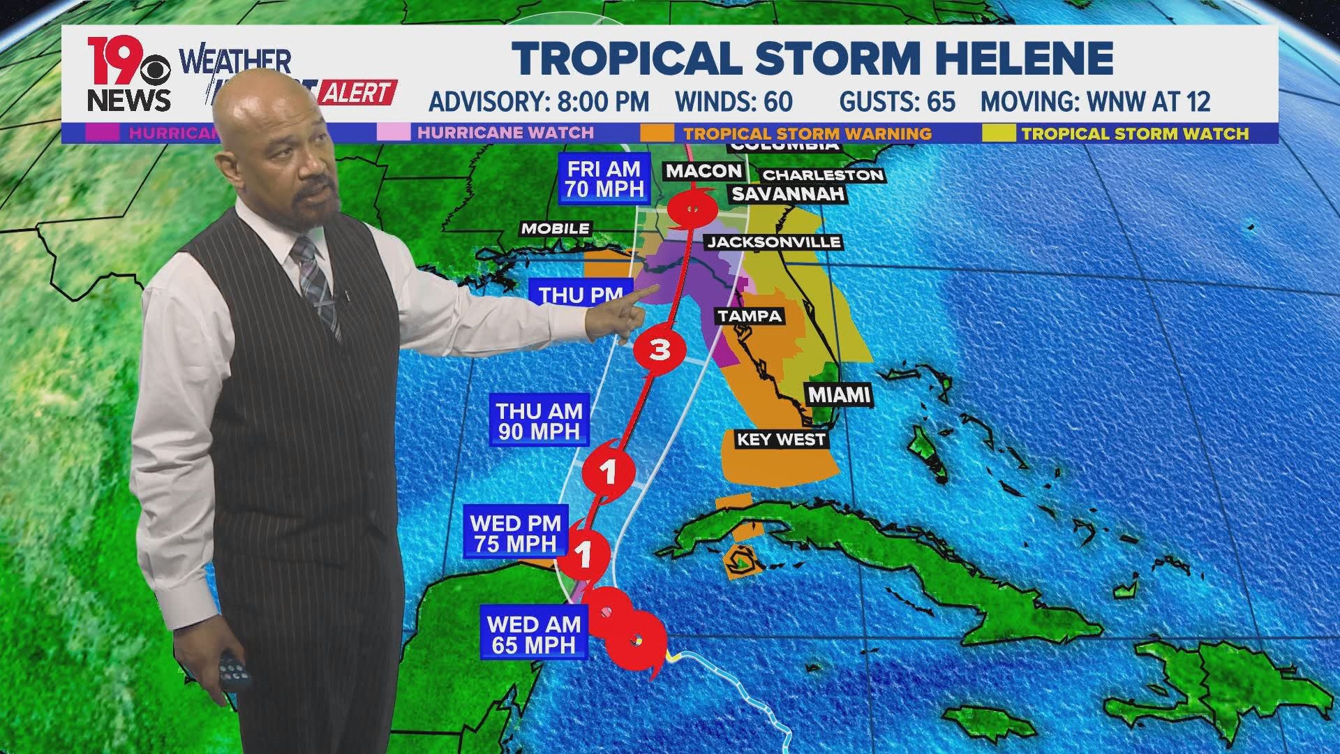
Right now, the system is still a tropical storm but is expected to intensify rapidly as it gets closer to the United States.
WHEN:
Looking ahead to Wednesday, temperatures will stay above average, though they may be a few degrees cooler than earlier in the week. Rain chances will increase, especially during the afternoon and into the evening as a weather front approaches from the west.
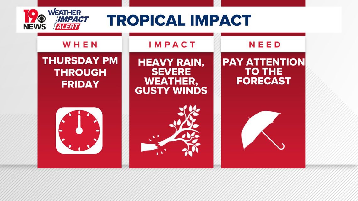
As Helene approaches closer to South Carolina, the greatest risk for the central part of the state will be from Thursday night through most of Friday.

The track of the storm does not directly take it into South Carolina, but it's important to remember, effects from a hurricane or tropical storm can be felt while outside the "cone" track released by the National Hurricane Center.


IMPACT:
Additional strengthening is forecast, and Helene is expected to become a hurricane on Wednesday. Continued strengthening is expected after that time, and Helene could become a major hurricane on Thursday.
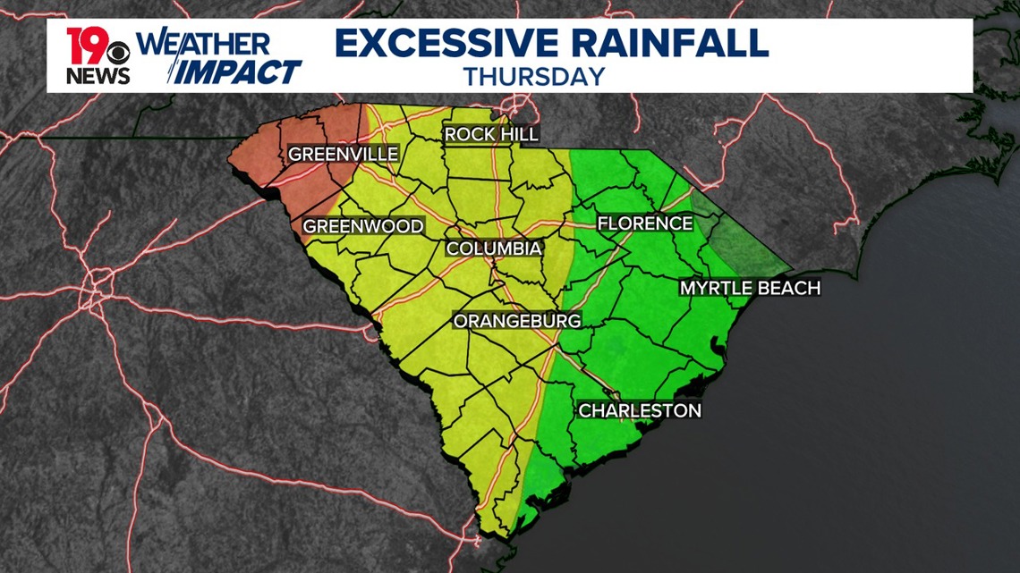
Helene is forecasted to bring total rainfall accumulations of 4 to 8 inches in the Midlands of South Carolina, This heavy rainfall is expected to cause significant flash and urban flooding, along with minor to moderate river flooding, and the possibility of isolated major river flooding.

As the storm approaches, heavy rain, strong winds, and isolated tornadoes are possible across the region. Flooding could occur in areas where rainfall accumulates quickly. Though the system is expected to move relatively fast, it may still cause significant issues across South Carolina. The storm’s interaction with a weather system to the west could keep rain showers in the forecast into the weekend.
NEED:
As Tropical Storm Helene continues to develop, it is important to monitor local weather updates for potential changes in timing, intensity, and impact. While the storm will not directly move through the area, the risk for storms means people need to make sure they have batteries or other supplies in case they lose power. You also should consider reviewing their escape/emergency plans in case a tornado warning were to be issue for your area, especially if you live in a mobile home which are not designed to stand up to high winds.