
COLUMBIA, S.C. — Tropical Storm Helene is currently moving away from South Carolina. The storm is expected to move west of the forecast area by midmorning and shift northwest by the afternoon, with diminishing winds as it departs. Dry weather is anticipated to return by Saturday, lasting into early next week, with seasonal to slightly above-average temperatures.
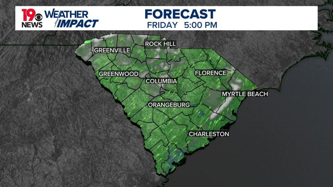
As the storm continues its northward journey, radar shows widespread rain across east-central Georgia, with the southern part of the storm system beginning to weaken.
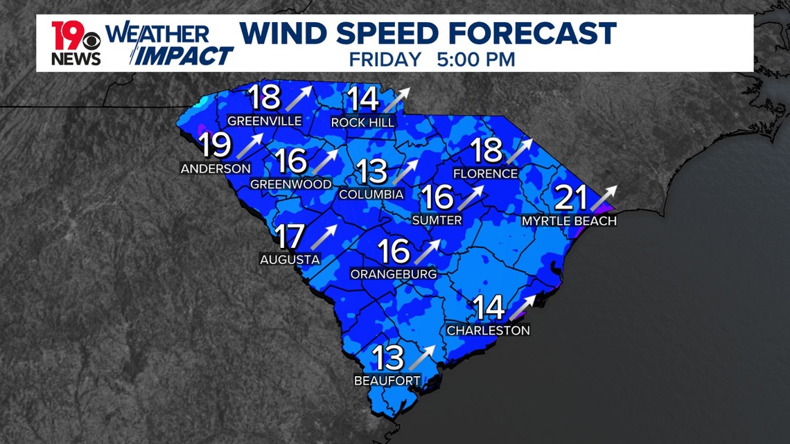
Tropical Storm Helene is weakening but continues to generate strong winds, with gusts of 50-70 mph reported. The Columbia airport reported a wind gust of 67 mph. Power outages and downed trees are widespread, with the strongest winds expected to ease later this morning.

Heavy rain has fallen over the past 24 hours, with some areas seeing over four inches of rain. With saturated ground conditions, additional rain may exacerbate flooding and increase the risk of falling trees.
By late morning, Helene will shift northwest toward Tennessee and Kentucky, bringing an end to rain in the mid-morning hours. Clearing skies are expected in the afternoon as drier air moves into the area, with winds subsiding.

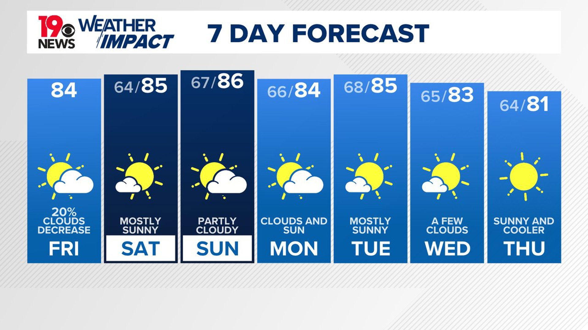
Highs will range from 80° in the west to the mid-80s in the east. Tonight, skies will remain partly cloudy, and winds will calm to 10 mph or less, with temperatures dropping to the low-to-mid 60s.
This weekend, a closed upper-level low over the Ohio River Valley will slowly move eastward, bringing a slight chance of isolated showers north of I-20, particularly on Sunday. Temperatures will remain slightly above average for late September. The excessive rainfall in Upstate South Carolina during the storm may cause minor to moderate river flooding this weekend.
Dry and warm conditions are expected to dominate next week. As the upper-level low-pressure system moves offshore and weakens, it will be replaced by high-pressure ridges. This shift will bring dry weather and temperatures 3-5 degrees above normal for early October. River levels are forecast to drop below flood stage by mid-week, providing relief from the heavy rain and flooding earlier in the week.