
The heat and humidity that the Midlands dealt with the past week is forecast to remain through the weekend. Both Saturday and Sunday are forecast to have temperatures in the mid-90s with afternoon showers and storms.
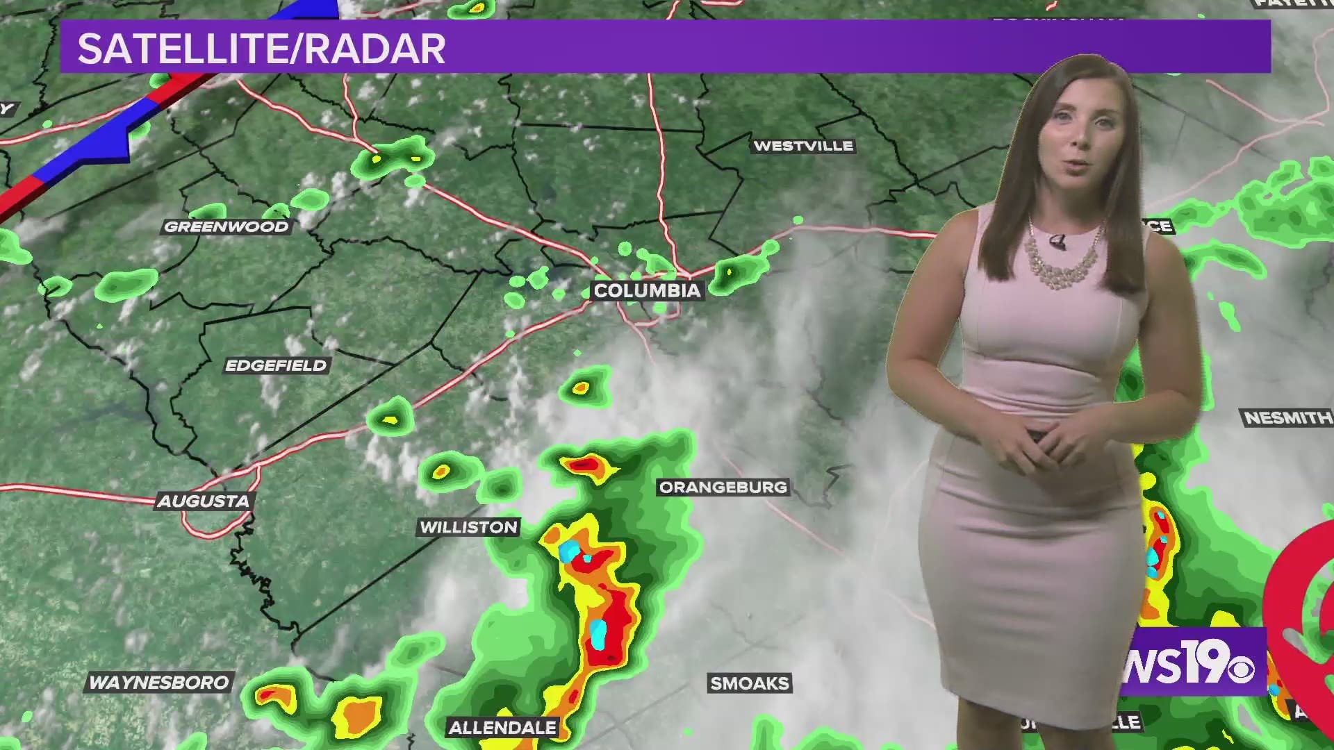
Saturday morning started out foggy with some rain along the coast and in the southern Midlands. As the fog dissipates and sun comes out in the afternoon, temperatures will quickly rise into the 90s.
The showers and storms will also begin to move into the area, starting closer to I-95 and then filling into the central and northern Midlands later in the day. The day will not be a washout, but keep the umbrella handy in case you do get caught under a quick downpour.

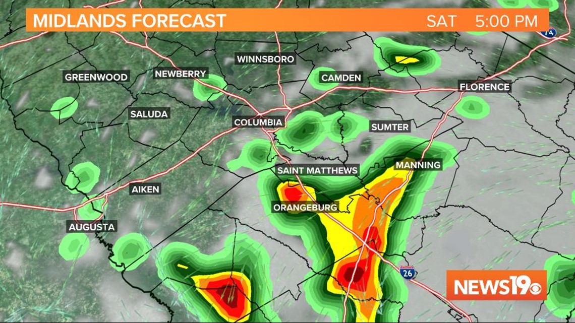
A stationary boundary draped across the Southeast is the trigger of the storms on Saturday. The boundary will stick around through the weekend, causing more isolated storms on Sunday as well.
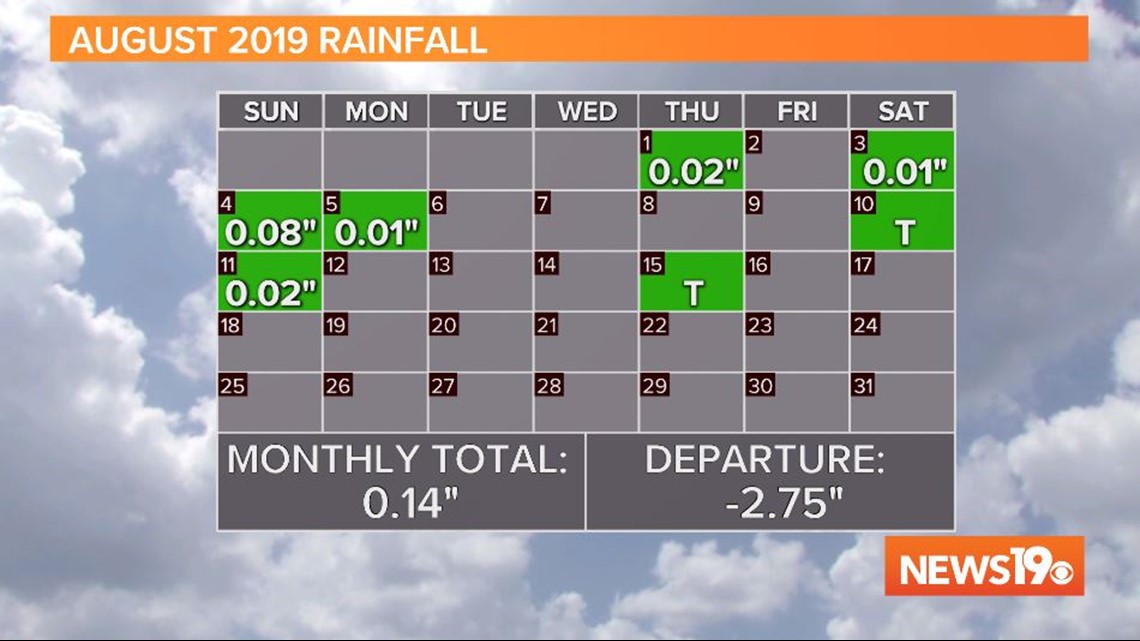
Any rainfall is much needed, as 78.11% of the Palmetto State is under abnormally dry conditions, with 8.5% of the state in a moderate drought.
Columbia Metropolitan Airport has not seen any significant rainfall in about a week. The airport is more than 2.5 inches of rain under where it typically is by this point in the month.

The unsettled pattern is forecast to last into the work week. With every day forecast at at least a 40% chance of showers and storms. With many starting school next week, make sure to keep an umbrella in your bag or backpack just in case.