COLUMBIA, S.C. — A non-tropical area of low pressure is expected to form near the United States' southeastern coast. While it is unlikely to develop into a subtropical or tropical cyclone, it will have a significant impact on the region, including South Carolina.
The storm is expected to move northward and impact South Carolina over the weekend. Saturday is expected to bring strong winds, dangerous surf, rip currents, and heavy rain along the coast. It will be breezy and rainy in the Midlands, especially on Saturday.
A non-tropical area of low pressure is expected to form along a frontal boundary off the southeastern coast of the United States in the next day or two.

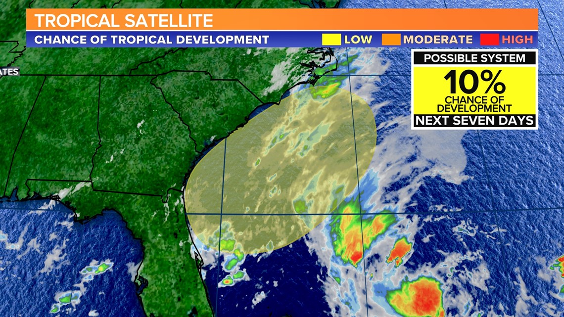
According to the National Hurricane Center, this weather system is unlikely to develop into a subtropical or tropical cyclone. The hurricane center currently assigns a 10% chance of further development to this area.
It is expected to keep its frontal characteristics as it moves northward, eventually making its way inland over the Carolinas during the upcoming holiday weekend.
Cloud cover will increase on Friday. The weather will be slightly cooler on the last day of the workweek. Temperatures are expected to top out in the middle 70s.

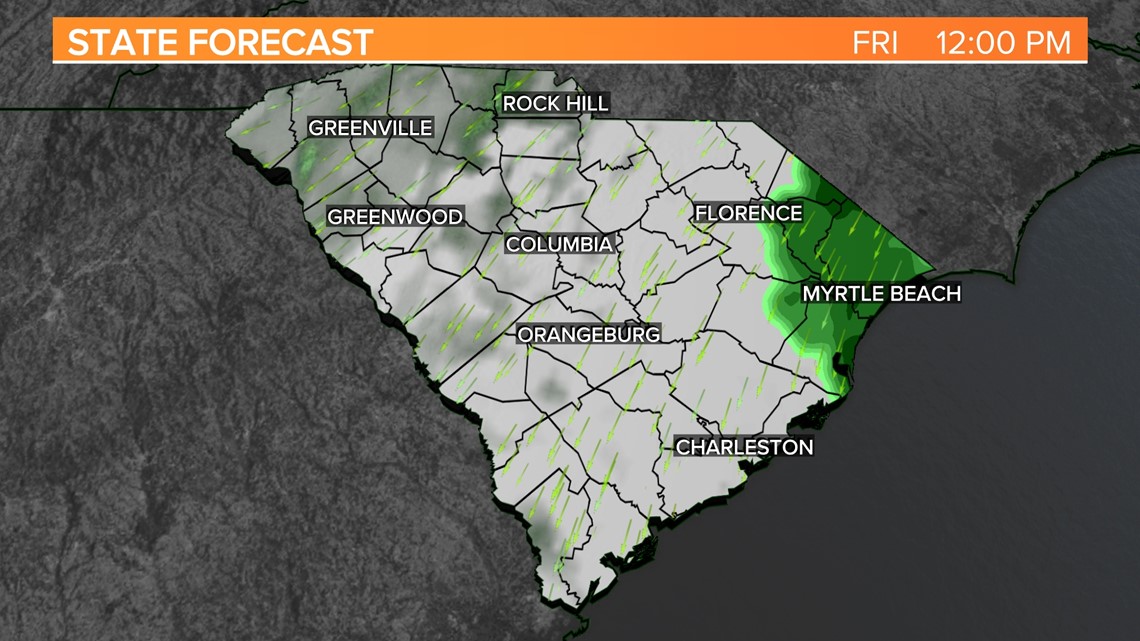
Rain will start to move into the area from east to west on Friday. Some rain is possible in the eastern half of the Midlands by the late afternoon hours. Rain will likely fall Friday night and into Saturday.
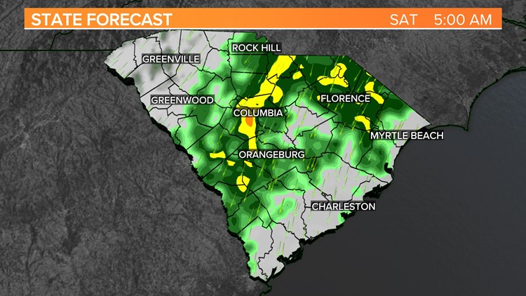
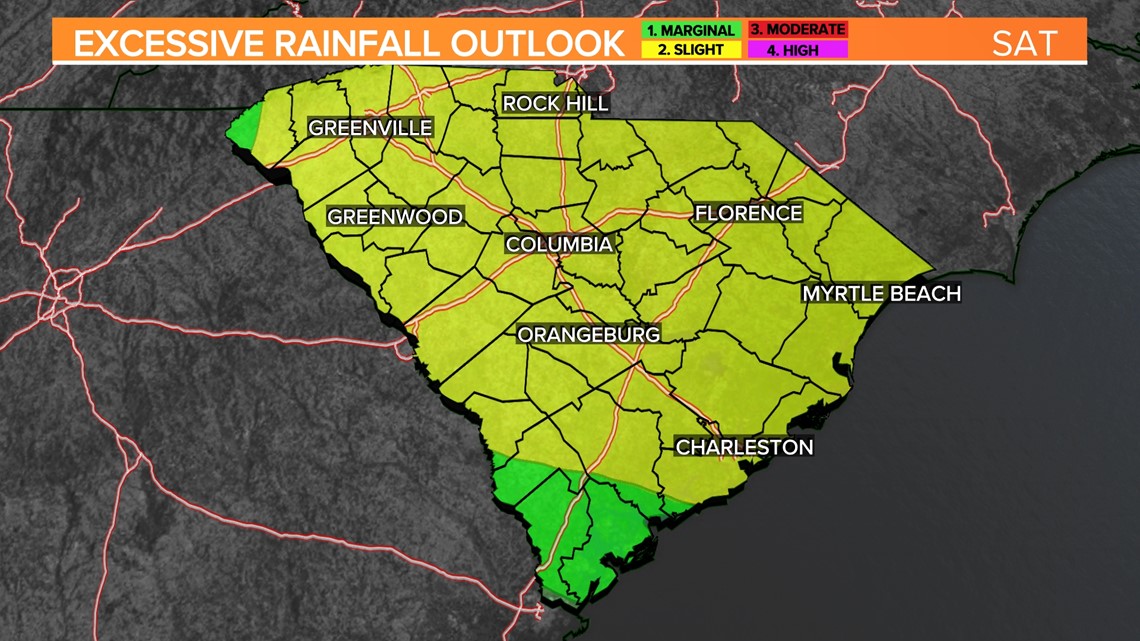
East of I-95 is under a slight risk for excessive rainfall Friday. There will be a chance of flash flooding in this area on Friday. Most of South Carolina is under a slight risk of flash flooding Saturday as the moisture streams in associated with the low.

The skies will be cloudy, and it will be very rainy Saturday. High temperatures may only top out in the middle 60s. The record minimum-maximum temperature for May 27 is 66 degrees. It will be windy, too. Winds will be out of the north at 15-25 mph, with some stronger gusts.
Rain will continue to stick around Sunday and into Memorial Day. Showers are possible on Sunday. There will be a chance for showers and a few storms on Monday.

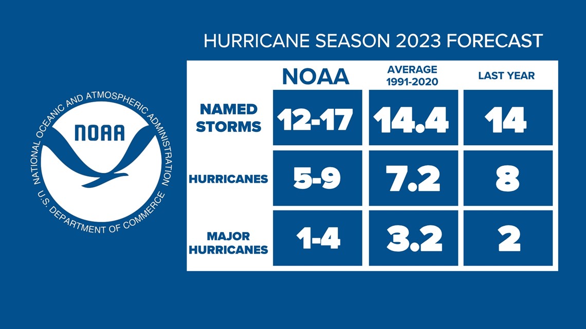
NOAA released its hurricane season outlook for 2023 on Thursday. The agency is expecting a near-normal season with 12-17 named storms, five to nine hurricanes, and one to four major hurricanes.