COLUMBIA, S.C. — This Thursday, a breeze will bring in the coolest and driest air we have seen since the spring. Surprisingly, our falls see some of the least windy days out of all the seasons in the Midlands.
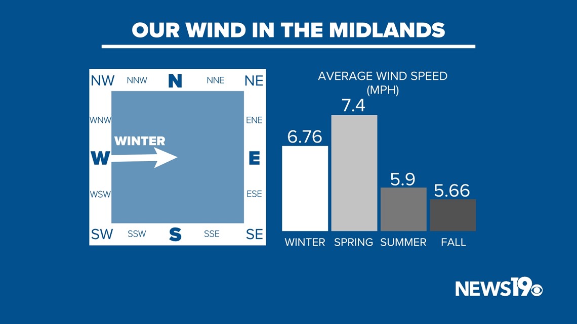
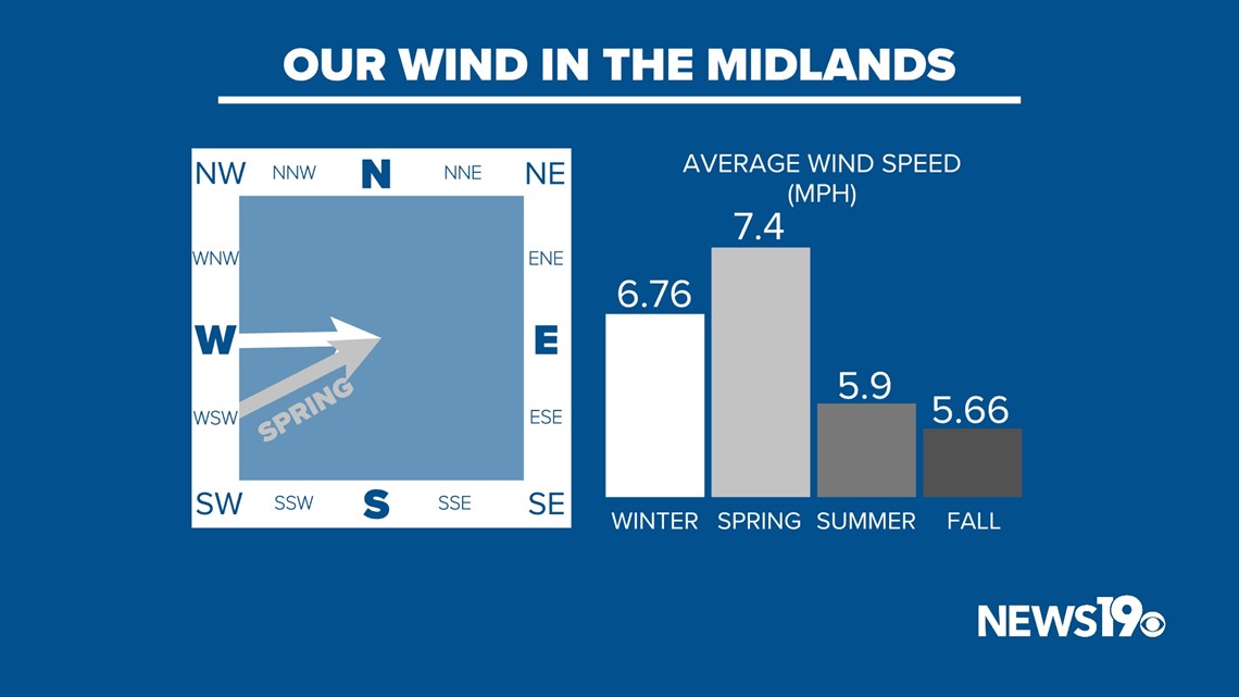
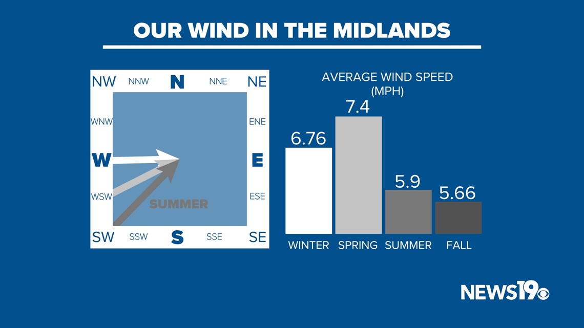
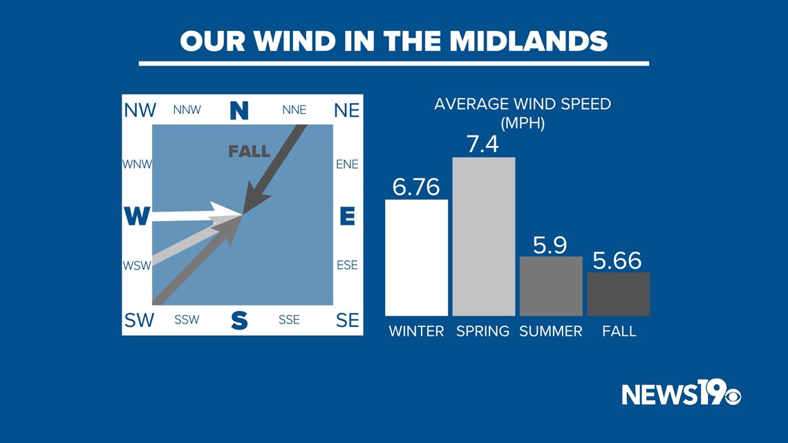
Fall averages around 5.6 miles per hour of wind compared to other seasons that range from 6 to 7 miles per hour. This might not seem like a lot, but you can see the differences in why each time of the year is different.
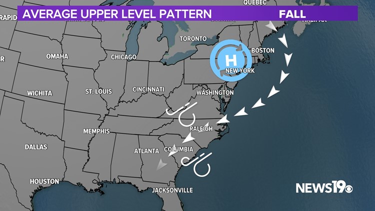
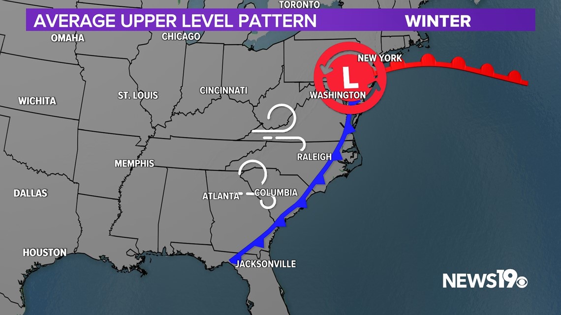
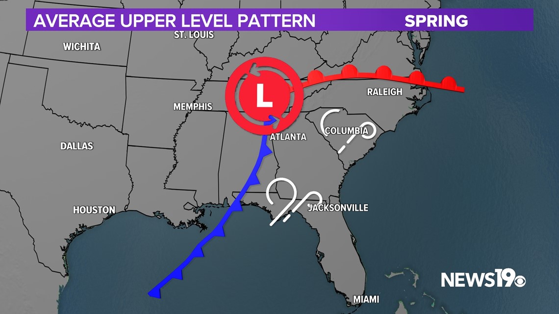
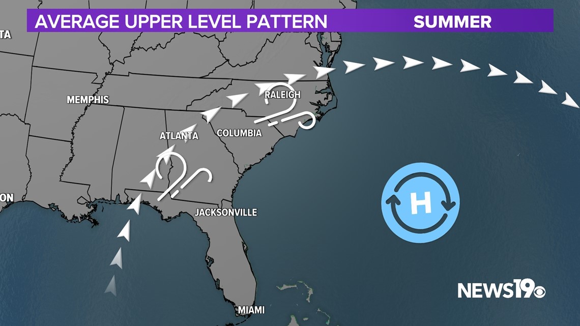
Starting with the upper level of our atmosphere, the most amplified patterns exist in the spring and winter. This sets the stage for large pressure gradients that create wind at the surface. Our typical patterns in the Summer are very stagnant with high pressure in control, meaning our wind mainly comes from storms in the afternoon and evening. Fall is very much an in-between season that remains warm but doesn’t support as many strong-winded storms.
When it comes down to the direction our winds come from, most of the year in the Midlands, southwesterly winds dominate.
Westerly winds are common in winter as cold fronts usher in cold air.


Springtime brings areas of low pressure that pump in plenty of warm air from the southwest, setting the stage for severe weather.


Summer months typically feature the southeast ridge, which means our winds constantly come from the southwest.


But, in the fall, cool air gets funneled in from the northeast thanks to high pressure.



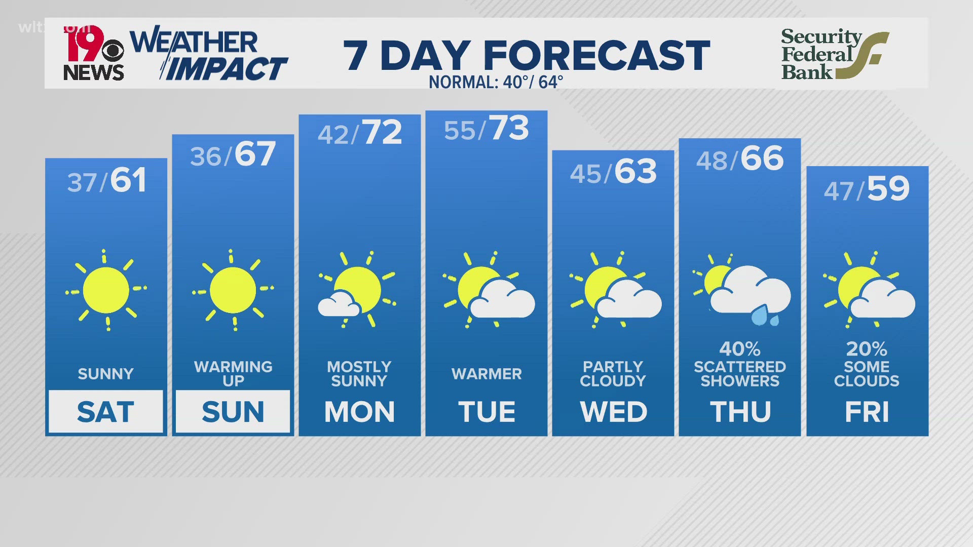
As for this week, just as climate tells us, our winds will bring cool air from the northeast, bringing us down into the low 80s.

