COLUMBIA, S.C. — We are starting off the weekend with plenty of sunshine but, as we get into the afternoon on Saturday the rain chances look to really ramp up.
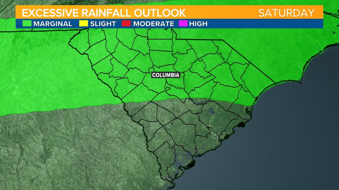
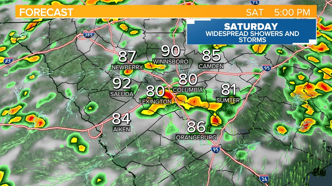
A cold front will be stalling across the area today. With plenty of moisture today already in place and highs getting into the lower 90s, we will likely see scattered to widespread storms forming across the region. Given the setup for the rain today, there is the possibility of seeing some locally higher amounts of rainfall with any storms that form. Because of this, the Weather Prediction Center has put out a low end chance of flash flooding.

As for the timing of any storms, the best window looks to be around 4-6PM but we can't rule out rain starting as early as 1 PM and lasting into the night hours here in the Midlands..

As we go into Sunday, the front will begin to drift northward. This will take the best chance for rain into North Carolina. We still can't rule out some scattered storms but, it looks like we will be somewhat drier than today.
Next week, rain will stick around in the forecast but only isolated at best. High pressure over the Atlantic will keep our winds out of the south. This is a very similar setup to last week so expect lower to middle 90s, with some rain sticking around in the forecast. Humidity will keep our heat index values pretty high right around 100 for most of next week.