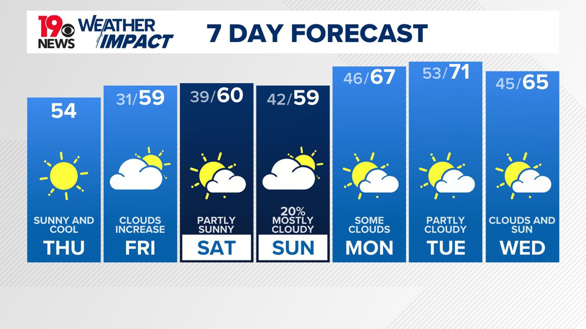
COLUMBIA, S.C. — We have one more day of relatively cooler weather before the arctic chill arrives in the Midlands.
This morning we have seen some heavy rain and even some thunder push through the area. This is all associated with a weak area of low pressure situated off the coast. This rain chance looks to end by the late morning although we cannot rule out some stray showers later on. Conditions look to remain mostly cloudy with temperatures reaching the upper 40s to nearly 50 in the afternoon.
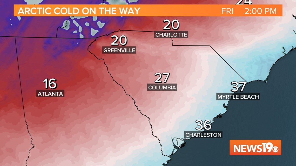
Friday is when we see the big changes in our weather, and things look to start changing pretty early. Temperatures will likely be near 50 to start the day but, around 5 a.m., as the cold front moves through during this time, temperatures will drop drastically into the 20s by the late morning.

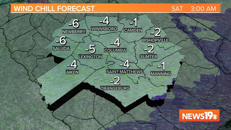
Winds will be pretty strong behind the front gusting anywhere from 30 to 45 mph. This, along with the cold temperatures, will make things feel much colder than they actually are. Wind Chill values during the day look to be in the teens.

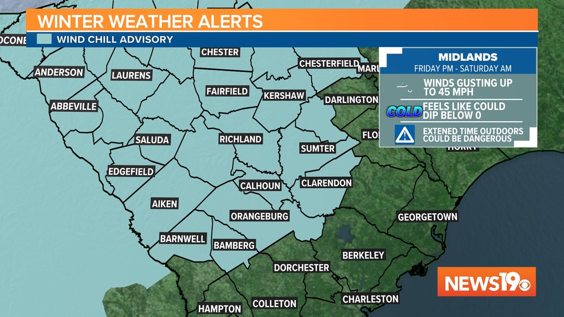
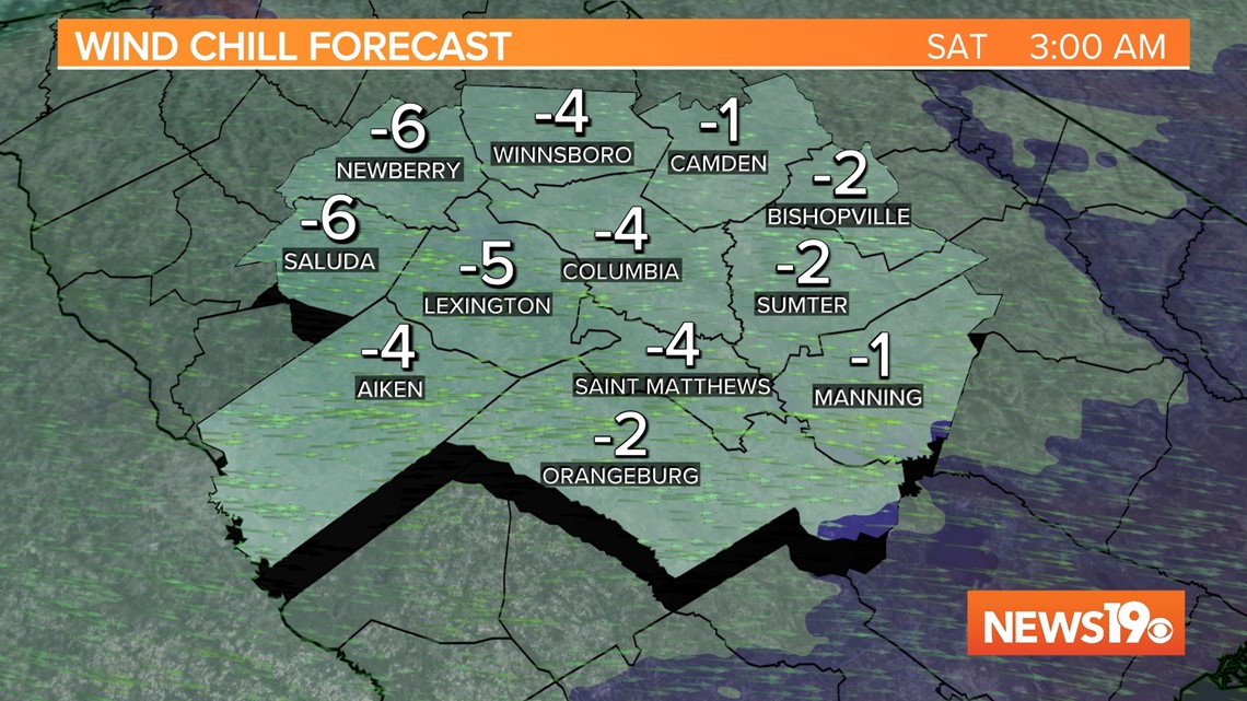
As we go into the overnight those wind chill values look to approach 0 degrees if not go below zero. Because of this, the National Weather Service has issued the first Wind Advisory in the area since 2018. Conditions during this timeframe will be unsafe for those that are not properly dressed and it is best to be inside if you can be.

Looking at Christmas Eve we could set a record low if things come together but it is looking much more likely that we break the coldest high-temperature record for that day. We will likely stay below freezing the entire day heading into Christmas Day where we will be slightly warmer in the upper 30s.