COLUMBIA, S.C. — We could be seeing the coldest weather since 2018 as we end out this weekend as lows are expected to reach the middle teens Saturday morning.
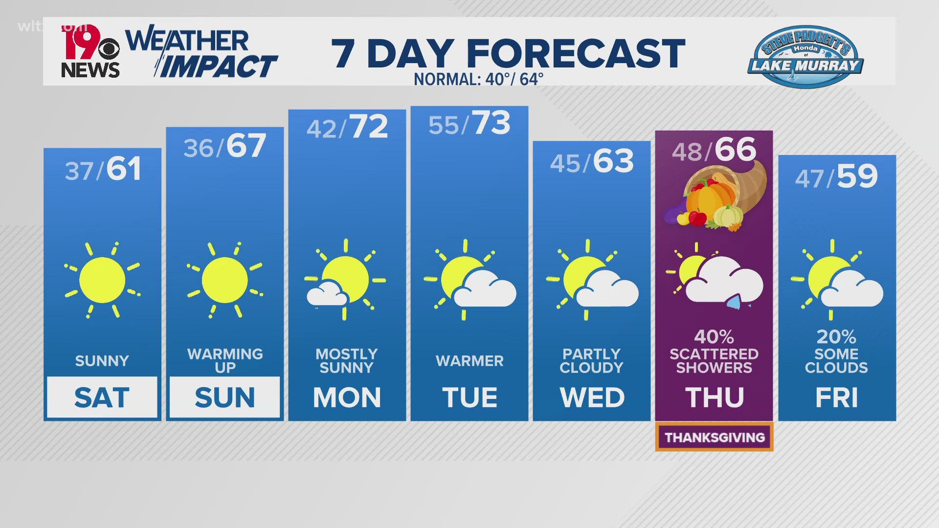
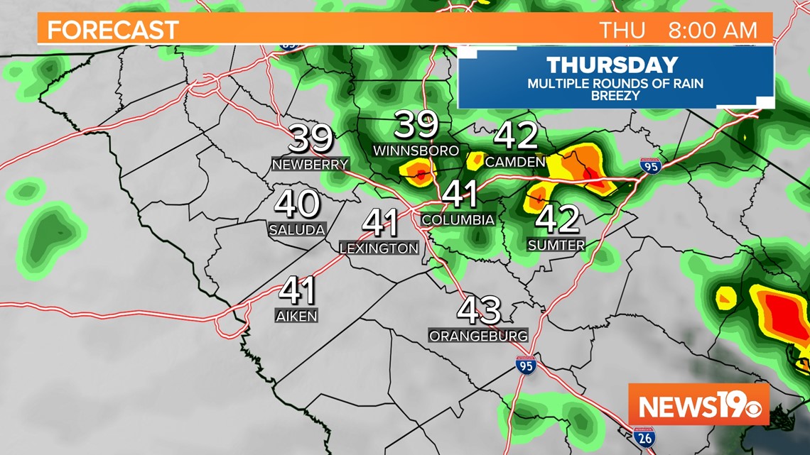
Before we get there, we are tracking some isolated rain chances today with more widespread rain expected on Thursday.
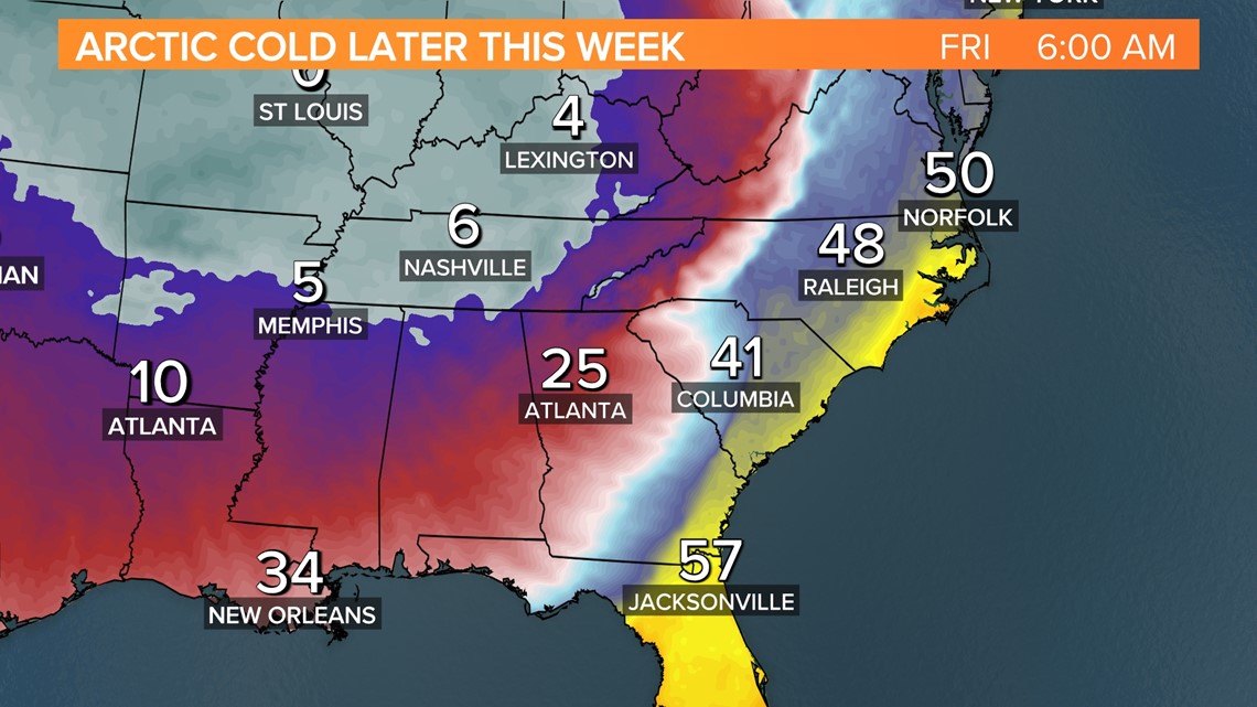
The big story will be the cold air as we get towards Friday. A very potent upper level trough will be building in with this system which will set the stage for Arctic air to dive to the south. Parts of the central and eastern US will see temperatures well below normal with a good portion of the country seeing wintry weather.

While we aren't expecting any wintry weather here in the Midlands, we are expecting some frigid conditions. A cold front will arrive Friday morning causing temperatures to drop quickly.

Winds will be pretty gusting as high as 40 mph behind the cold front on Friday thanks to the tight pressure gradient. This will allow the wind chill along with temperatures to plummet. Temperatures Friday afternoon will likely be in the 30s to maybe even upper 20s.

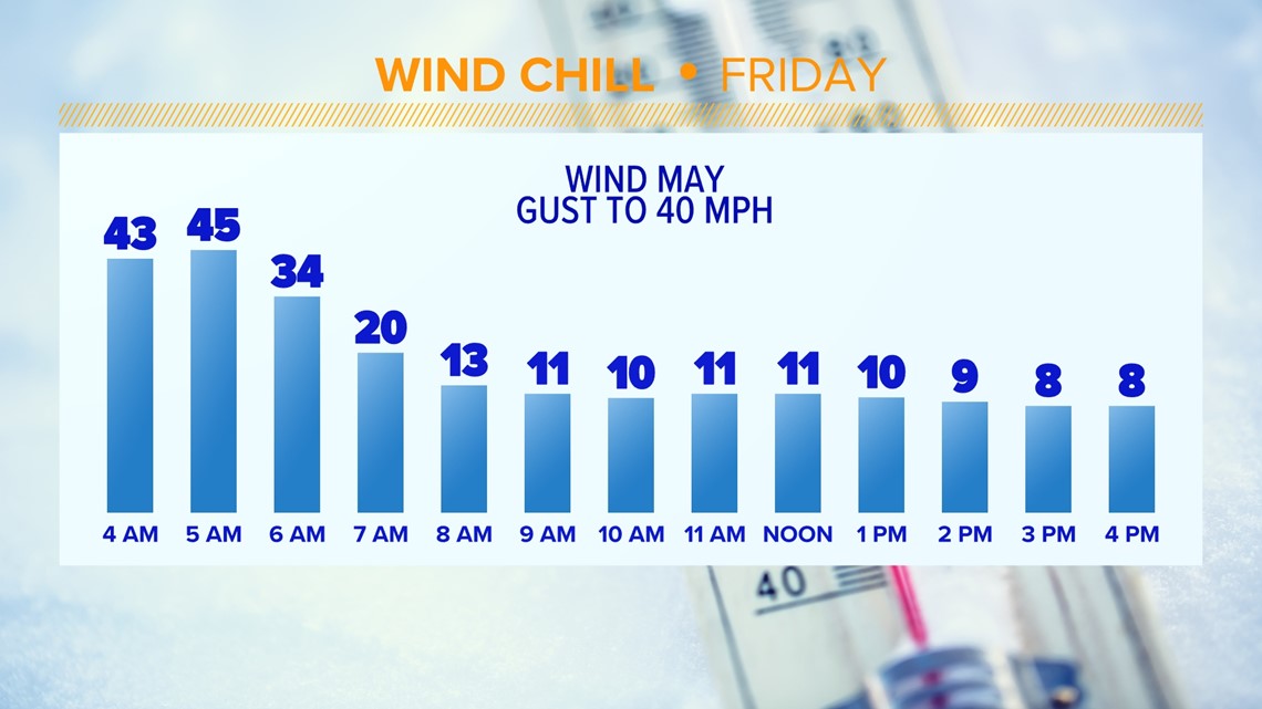
Friday night, lows are expected to go down to the middle to upper teens but, with the wind present, the wind chill will likely get down into the low single digits for most of the Midlands.

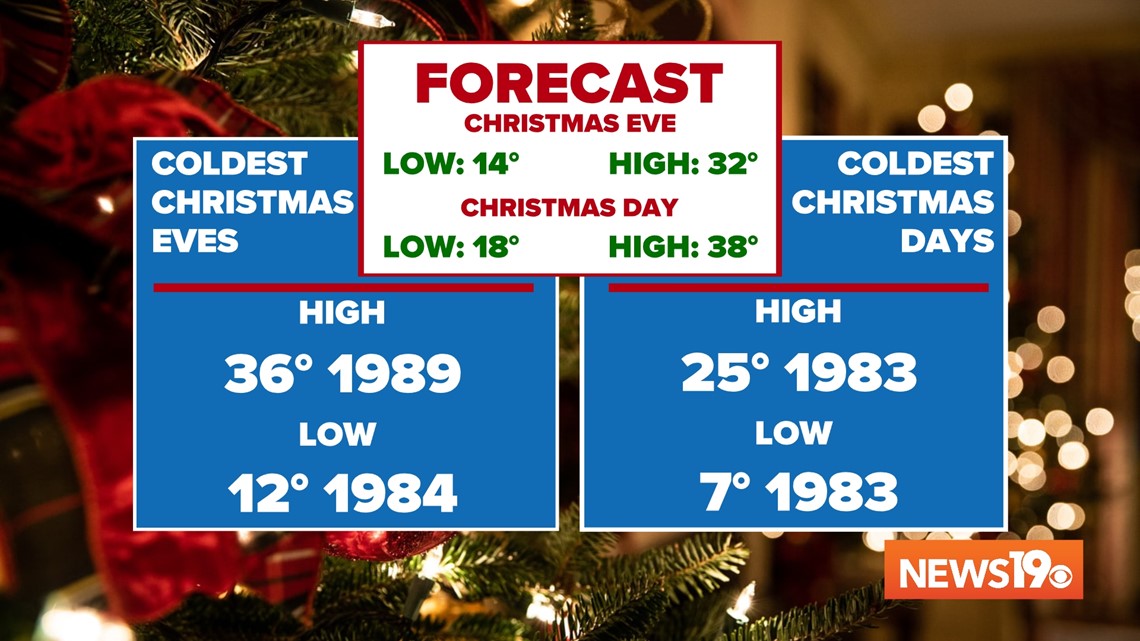
Temperatures in the morning will likely be a few degrees to warm on Saturday to break any records but, our daytime high is looking to possibly set the record for coldest Christmas Eve Day on record with highs only in the lower to middle 30s.This could end up being the first day we don't get above freezing in Columbia since 2014.
Christmas day looks to be a few degrees warmer which should keep us from breaking records but, could also be the coldest Christmas Day since 1998 here in the Midlands.