COLUMBIA, S.C. — As we already know, December was very warm. In fact, it finished around 8 degrees above normal across the state of South Carolina. 2021 saw plenty of temperature and precipitation swings but, what can that tell us about what we can expect when it comes to 2022's weather?
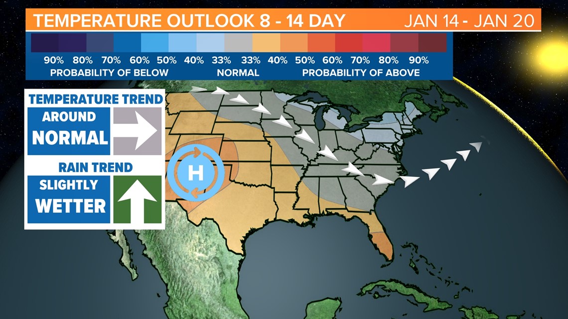
Well, the answer is not much. While patterns that ended 2021 on the warm side are still in place, month-to-month correlation is not typical in the world of weather forecasting. According to South Carolina State Climatologist Hope Mizzell, the La Nina pattern that we have seen so far this winter will likely dictate how things progress. "So as we go through the rest of winter we will have to wait and see because yes, as we were heading into this winter; November we were warmer than normal and drier than normal. December was warmer than normal (but) not so much drier than normal. But, the official forecast for the remainder of winter is that we will have above normal temperatures and below normal precipitation."
While short-term trends don't always show us what to expect, it can still be helpful to look at the important weather that we saw from year-to-year.
RELATED: Local Forecast

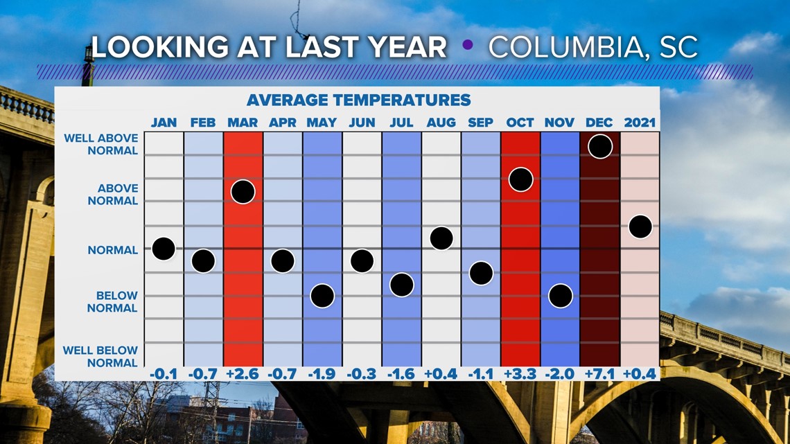
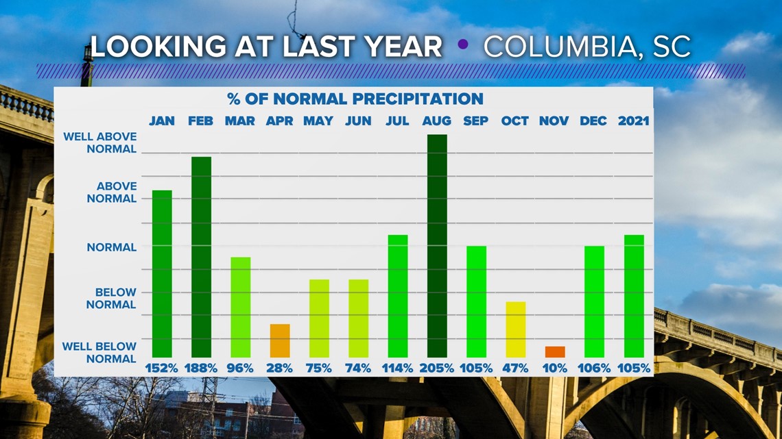
Looking more in-depth into what we saw in 2021 here in the Midlands, it really was a mixed bag outside in terms of our weather. Temperatures for the most part, trended more warm than they did cold. As for precipitation, outside of a wet start and June, most of the year trended at or below average for rainfall here in the Midlands.


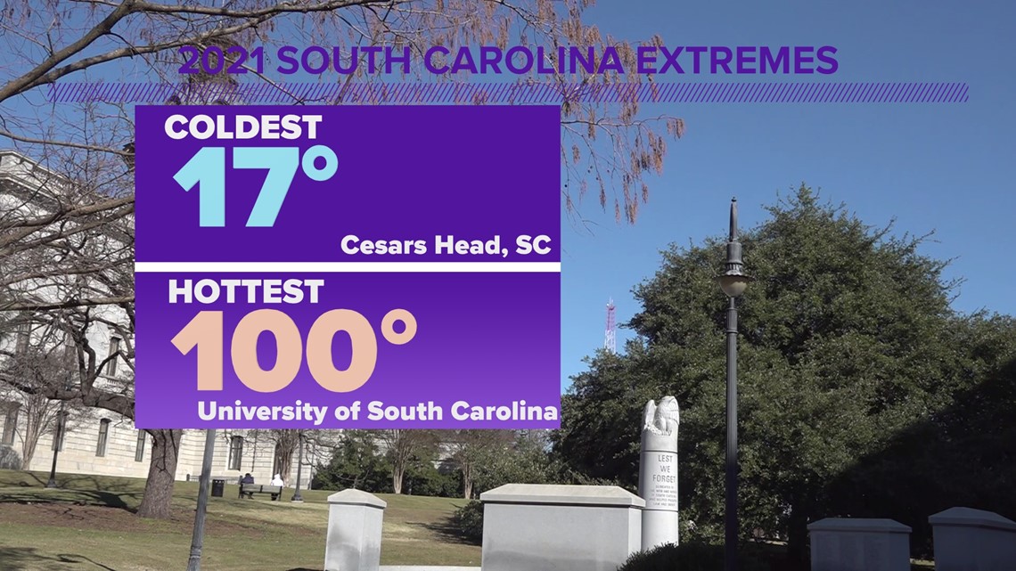
Taking a look at our extremes across the state last year, the warmest high of the year was recorded right here in Columbia at the University of South Carolina where 100 degrees was recorded back in May. Of course, the coldest weather was recorded in the Upstate where Caesars Head reached a chilly 17 degrees.

