COLUMBIA, S.C. — Tropical Storm Colin has come and gone within 24 hours. The National Hurricane Center says the system no longer has tropical characteristics as storms continue off of the North Carolina coast. The biggest impacts from this storm were the rainfall totals which were about 2-3 inches across portions of the Midlands with up to 7 inches near Charleston.
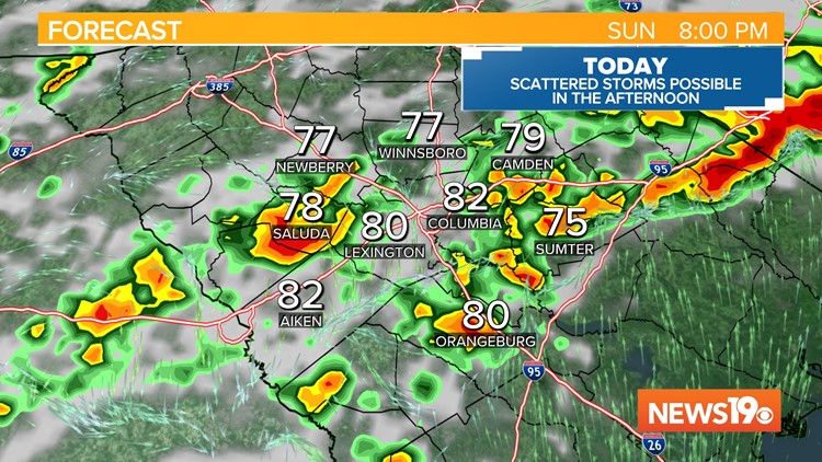
Looking towards today, we do see the chance of rain return into the forecast once again thanks to a cold front that will be moving in from the north later today. This front is expected to stall in the region keeping rain in the forecast for the next few days.


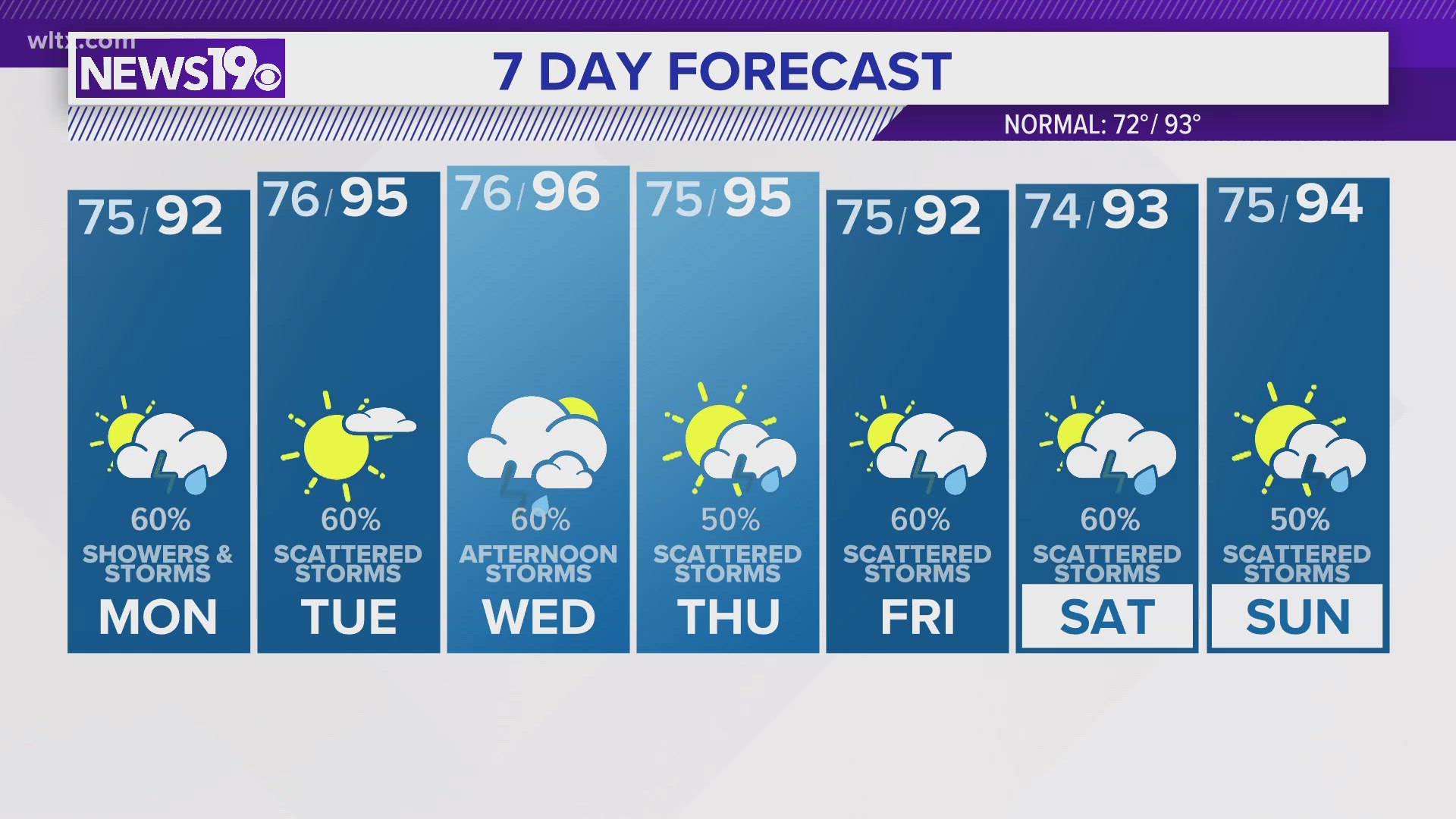
Highs are expected to be on the hot side across the Midlands reaching the middle 90s in the afternoon.
Scattered storms are likely this afternoon and evening so any outdoor plans may need to be moved indoors as the rain moves through. Some models keep rain in the area through about 10 PM tonight.
The 4th of July looks to be similar to today with highs in the lower 90s and a chance of thunderstorms once again in the afternoon and evening hours.

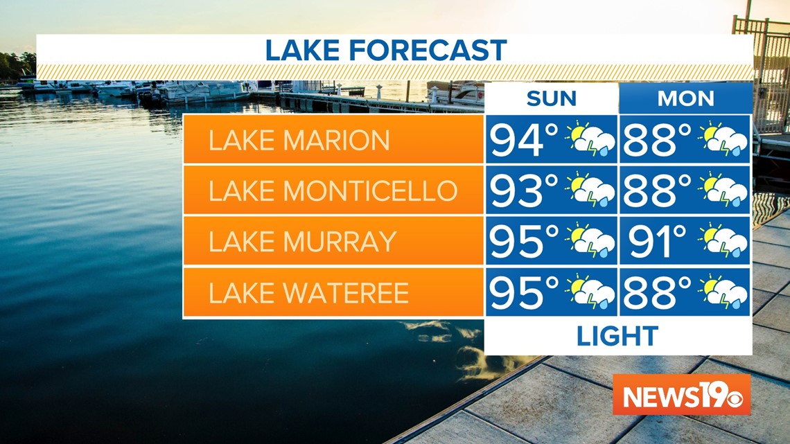
For the rest of the week, the weather looks to be pretty "typical" for this time of the year. lows will be on the warmer side in the middle to lower 70s each morning with highs in the lower to middle 90s. Almost every day we will see the chance of at least some thunderstorm activity here across the Midlands.