COLUMBIA, S.C. — The wet weather in the Midlands is going nowhere as showers and storms stick around in the forecast going forward.
The upper level low pressure that has brought us rain so far this week continues to pump moisture into the region. This has led to more rain to start off Tuesday and could lead to some heavy rain tonight and going into tomorrow.
Scattered storms will be possible through the afternoon but, models have begun to focus on the opportunity of some more steady rain this evening and going into Tuesday night. Flash Flooding will be a concern during this period as many places have seen multiple rounds of rain already today.

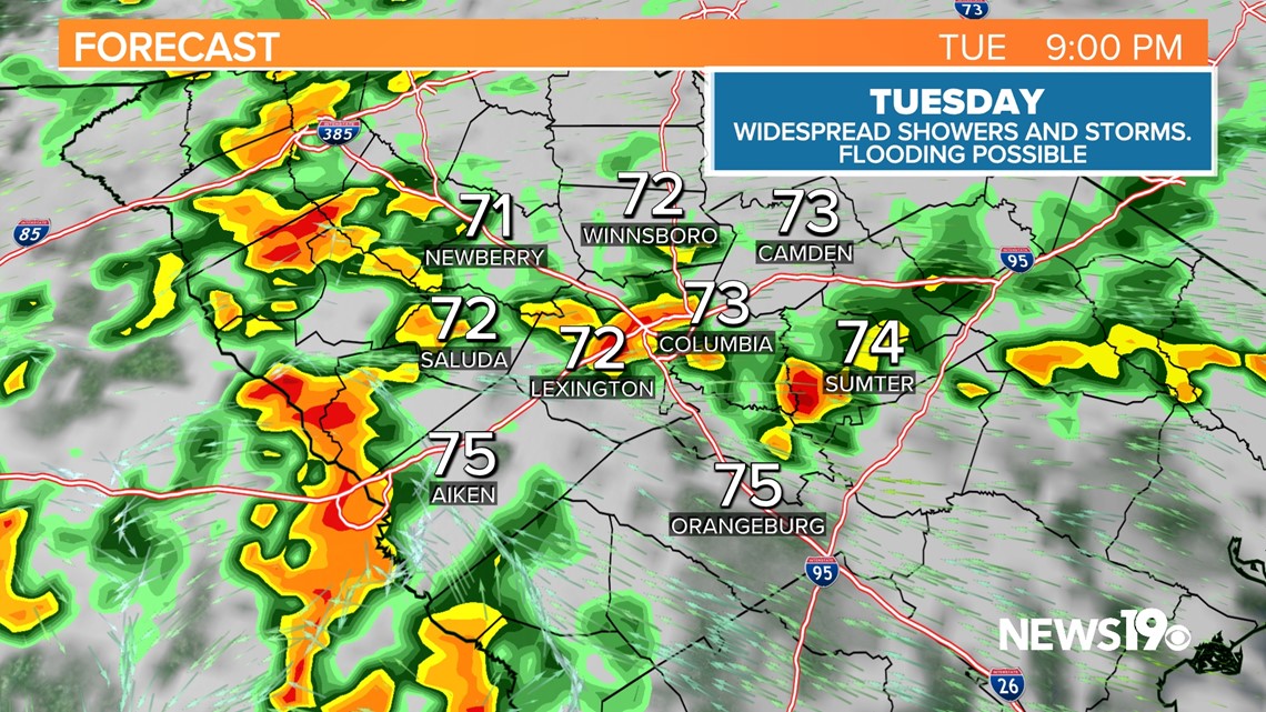
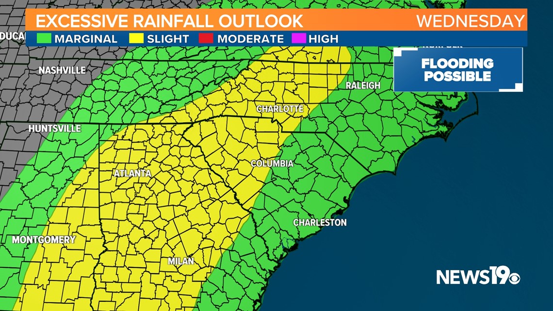
This widespread rain looks to continue going into Wednesday where the chance of Flash Flooding looks to be possible once again as heavy rain effects already wet communities.

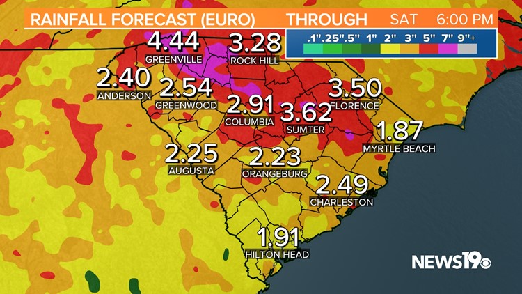
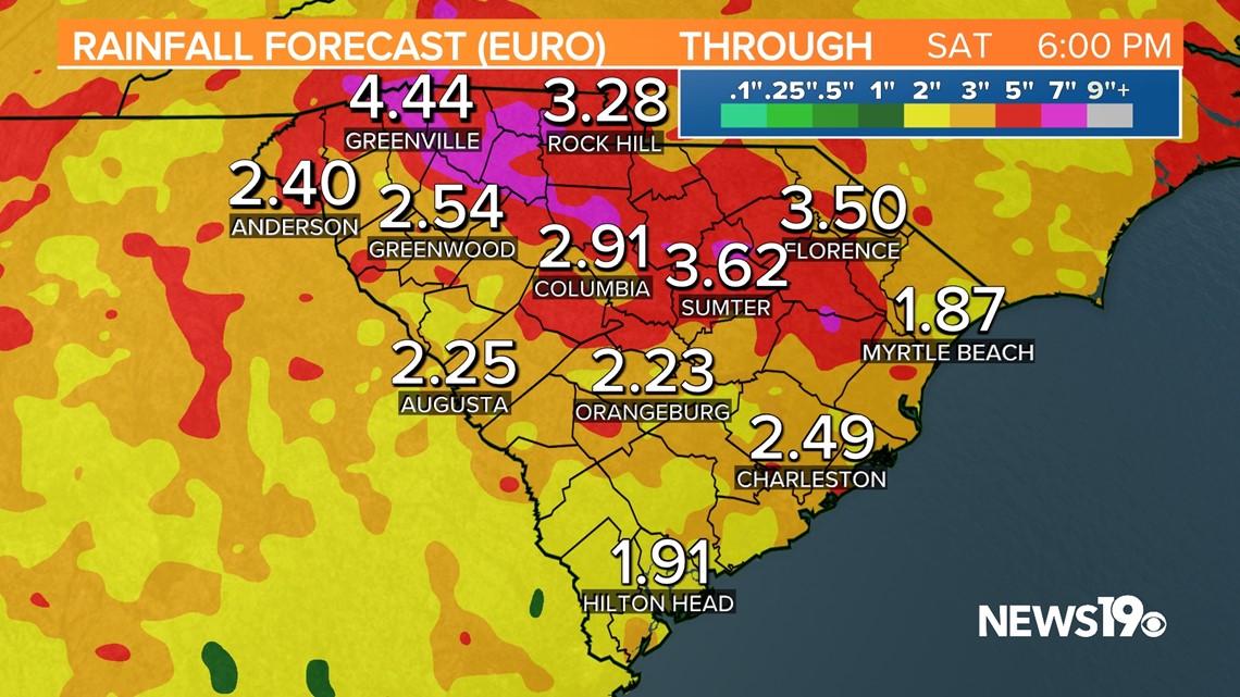
As of right now, another 3-5" of rain looks possible in the Midlands between now and the end of the work week. This is shown on the rainfall forecast on the European model quiet well.

The good news is that after this, the weekend is trending somewhat drier with more typical summer storm chances in the afternoon amounting to only about a 30% chance of rain.
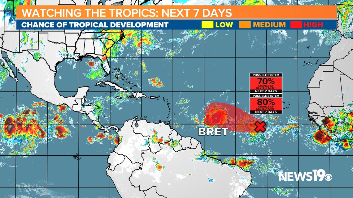
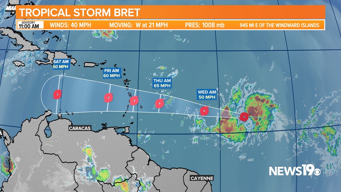
The tropics remain very active for this time of the year. Tropical Storm Bret has been struggling with shear and will continue to do so. Because of this, the National Hurricane Center only expects the system to be a tropical storm now as it continues west.

Behind this system is another tropical wave, 93L which now has an 80% chance of becoming a system. This storm is being modeled to curve north out to sea which means it in theory should have no impact to the US.